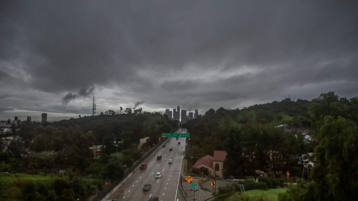
LOS ANGELES (CNS) – The first in a trio of storms is expect to hit the Southland late Sunday evening or early Monday, bringing colder winter temperatures and significant rainfall to the valleys and inland areas and snow to the mountains, according to the National Weather Service.
This first storm is expected to be the heaviest and produce the greatest overall rainfall totals, with forecasts calling for about 1 to 3 inches in coastal and valley areas and 2 to 5 inches in the mountains by late Monday, the NWS said.
The city of Los Angeles issued evacuation warnings for people living in burn scar areas, after a flood watch was issued for a wide swath of Los Angeles County from Monday morning through Monday evening. Rock and mud slides are possible near steep terrain, and debris flows are possible on burn scars.
Mayor Karen Bass warned residents in those areas to take precautions and be prepared for potential emergency warnings.
“Ahead of heavy rain forecasted this week, first responders, Public Works crews, and city personnel are taking action to keep Angelenos safe and will be ready to respond to any potential impacts,” Bass said in a statement late Saturday. “This is likely to be another significant rain event. All Angelenos — especially those in burn scar areas — are encouraged to follow official guidance, use caution on the roads, plan ahead, and stay informed.”
Los Angeles County Board of Supervisors Chair Hilda Solis added her own warning for county residents.
“Los Angeles County is ready,” she said Sunday. “Representatives from the Los Angeles County Sheriff’s Department, Fire Department, Department of Public Works, and Office of Emergency Management are working together to prepare and keep our communities safe.
“We are also taking steps to protect our most vulnerable residents. Our Department of Homeless Services and Housing is coordinating outreach to ensure individuals in high-risk areas are informed of available resources and connected to shelter during the storm. The county has activated motel vouchers to support augmented existing shelter, and outreach teams will continue active engagement and prioritize motel placements throughout the weekend.
“Evacuation warnings are in effect for select parcels near areas burned in recent wildfires from 9 p.m. tonight through 9 a.m. Tuesday … Residents in those areas are urged to remain vigilant and be prepared to evacuate if an evacuation order is issued.”
Forecasters also urged people in flood-prone areas to be careful.
“Those living in areas prone to flooding should be prepared to take action should flooding develop,” forecasters said.
“We advise not to make plans for outdoor activities on Monday as conditions will be unusually hazardous,” the NWS’ Los Angeles office said.
Santa Anita Park postponed Monday’s special holiday racing program due to the declining weather forecast. A makeup day for the postponed Presidents Day card will be added to the Classic Meet prior to the end of the season.
Rainfall is expected to decrease in intensity Monday night into Tuesday, though scattered showers could linger as colder air moves into the region, according to meteorologists.
A wind advisory will be in effect from 6 a.m. to 6 p.m. Monday.
Snow levels are forecast to drop from around 6,500 feet early in the storm to near 5,000 feet Tuesday.
A second storm system is expected to arrive Tuesday night into Wednesday, bringing colder temperatures and the potential for additional rain and mountain snow. Forecasters said snow levels could fall as low as 2,500 to 3,000 feet at times, creating possible travel hazards on mountain roads.
An additional 1.5 to 3 inches of rain is likely on Tuesday and Wednesday, with a possibility of 3 to 6 inches of total rain in the mountains, according to the NWS meteorologists.
Temperatures will drop sharply beginning Monday, with daytime highs remaining in the mid-50s in most of Los Angeles and Orange counties all week, and dropping to the low 50s and even upper 40s in the Santa Clarita and Antelope valleys.
Overnight lows will be in the 40s in most areas, but will drop into the 30s in the mountains, Santa Clarita Valley and the high desert from Tuesday to Friday.
Thunderstorms combined with strong winds and rough seas could also create dangerous marine conditions early next week, forecasters said.
The third storm system is expected Thursday, but meteorologists say the moisture levels are unconfirmed.
Los Angeles residents can monitor emergency alerts at NotifyLA.org.

Recent Comments