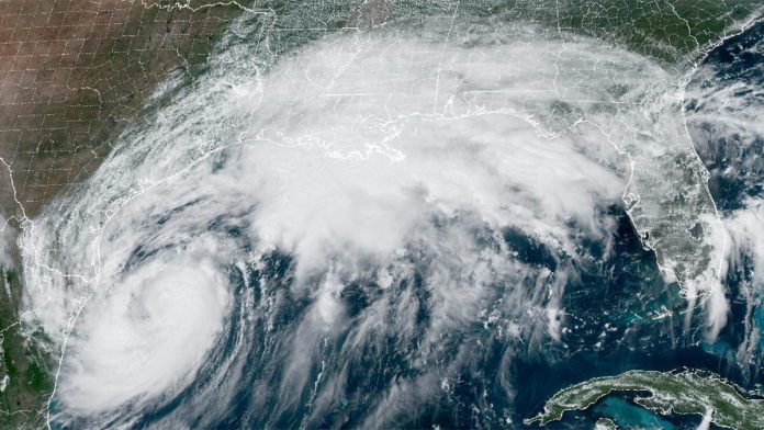
Tropical Storm Francine, currently gathering strength in the Gulf of Mexico, is expected to make landfall in Louisiana as a Category 1 hurricane, according to the latest forecasts. Initially, meteorologists predicted that Francine would intensify to a Category 2 storm, but recent updates suggest it may remain a Category 1 hurricane. However, experts caution that intensification forecasts can routinely be off by one category in either direction.
According to Weather.com, even though the storm’s track has Southeast Texas completely out of the cone of uncertainty, the region could still experience effects from Francine. Coastal areas are likely to face strong surf, rip currents, and a potential storm surge of one to three feet, which could lead to coastal flooding.
A Tropical Storm Watch has been issued for areas along the coast, including Galveston Bay. The storm surge is expected to peak between one to three feet Wednesday morning, causing coastal flooding in low-lying areas. Some roads, like Highway 87 in Bolivar, may be closed, and beach access in some areas could be blocked.
As Francine approaches, minor rain bands are slowly moving towards coastal communities, with more expected to arrive later today. This could result in wet roads and a challenging evening commute. Isolated street flooding along the coast is also possible, especially as high tide approaches late Tuesday night.

Recent Comments