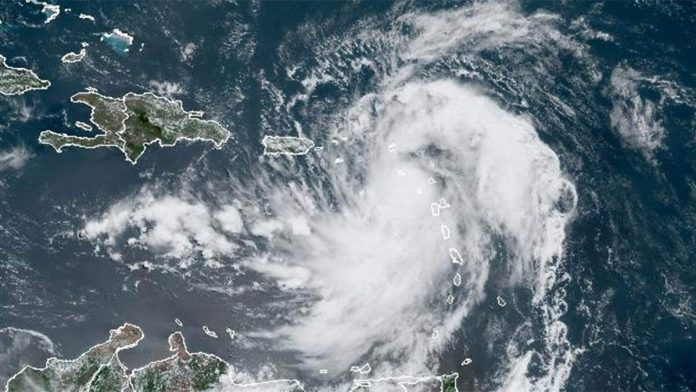
Tropical Storm Ernesto, the fifth named storm of the 2024 Atlantic hurricane season, is expected to strengthen into a hurricane by Thursday (August 15), according to the National Hurricane Center. As of Tuesday morning, Ernesto was generating top sustained winds of 50 mph and was moving at 18 mph. The storm is expected to pass near or over the Virgin Islands and Puerto Rico on Tuesday evening, bringing heavy rain, strong winds, and rough surf.
A hurricane watch is in effect for the U.S. and British Virgin Islands, and the islands Vieques and Culebra. A tropical storm warning is also in effect for several other islands, including St. Kitts, Nevis, Montserrat, Antigua, Barbuda, and Anguilla, as well as Guadeloupe, St. Martin, and St. Barthelemy, Saint Maarten, the U.S. and British Virgin Islands, Puerto Rico, Vieques, and Culebra.
The storm is expected to produce between 4 and 6 inches of rain over the Leeward and Virgin Islands, and 3 to 6 inches, with maximum amounts of 10 inches, over Puerto Rico. Storm surge levels could rise as much as 3 feet and bring “large and destructive waves.” The Leeward Islands could also see “considerable flash flooding and mudslides,” according to the National Hurricane Center.
After passing Puerto Rico and the Virgin Islands, Ernesto is forecast to turn northward over the western Atlantic. Additional strengthening is expected during the next few days, and Ernesto could reach hurricane strength by Thursday over the waters north of the Greater Antilles.
While the eastern United States is not expected to be directly impacted by Ernesto, the storm will likely bring “dangerous seas and rip currents” to the southeastern U.S.

Recent Comments