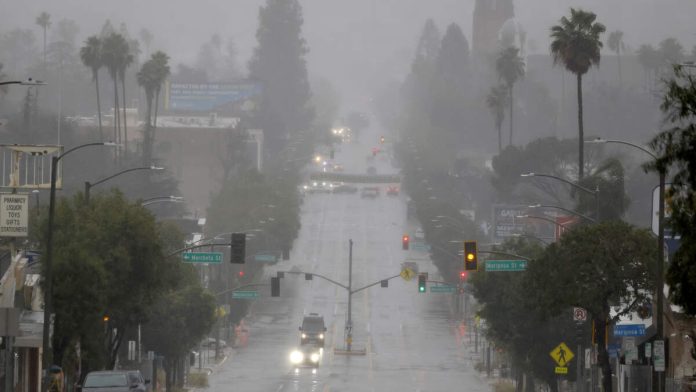
LOS ANGELES (CNS) – A third storm system brought more rain to an already saturated Southland Thursday, again raising concerns about possible mud and debris flows and the possibility of downed trees and power lines due to gusting winds.
Rain began falling in parts of the Southland just in time to dampen the morning commute for many residents. The rainfall rate was generally “pretty tame” in most areas, although some localized areas saw brief downpours of a half-inch per hour, according to the National Weather Service.
Overall, however, less than an inch of rain was anticipated Thursday. The snow level was expected to drop as low as about 3,000 feet, and some snow was already spotted in the Grapevine section of the Golden State (5) Freeway Thursday morning.
Even more noticeable were the winds, which picked up Thursday morning and reached speeds of 50 to 65 mph in some mountain areas, according to the NWS.
A high wind warning will be in effect until 9 p.m. in the Antelope Valley, where winds of 25 to 40 mph were expected, gusting as high as 65 mph. Forecasters warned that the winds could “blow down trees and power lines,” adding that “widespread power outages are possible.” The winds also made driving complicated, particularly for high-profile vehicles.
Most other parts of the Southland will be under a wind advisory until 9 p.m., with the NWS forecasting winds of 15 to 30 mph, gusting up to 45 mph.
Forecasters said 5 to 10 inches of new snow could fall in mountain areas above 6,000 feet, while as much as an inch could fall on the Grapevine.
A winter storm warning will be in effect until 7 a.m. Friday along the 5 Freeway corridor, with 1 to 4 inches of snow possible at lower elevations and up to a foot above 4,500 feet, according to the NWS. The warning will also be in effect for the San Gabriel Mountains, Antelope Valley foothills and the 14 Freeway corridor.
“Travel on mountain roads may be affected by accumulating and blowing snow (Thursday) and (Thursday night) and anyone traveling across the mountains should be prepared for treacherous wintry driving conditions, delays, or road closures,” according to the NWS. “Your vehicle should always have an emergency kit stocked with extra blankets, clothing, food, and water when driving in winter weather conditions. Snow will turn to showers this afternoon or evening, but moderate shower accumulation will occur for several hours after the storm has passed, especially along the north facing slopes of mountains.”
Cooler temperatures are expected to linger through Friday.
“A warming trend will develop on Saturday, but temperatures (will) remain on the cool side of normal,” forecasters said.
Topanga Canyon Boulevard, which had been closed in both directions since Sunday night from Pacific Coast Highway to Grand View Drive and was impacted by mud and debris slides during Monday’s rain, was reopened at noon Wednesday. That stretch of road, also know as state Route 27, is an active work zone for ongoing recovery efforts from last year’s Palisades Fire and winter storms. It is typically closed to the public from midnight to 5 a.m. daily. The road remained closed Thursday morning due to the rain, but it reopened again at 10 a.m., with crews reporting “minimal” precipitation, according to Caltrans.
Very large waves are expected across coastal waters through Friday night. High surf advisories and beach hazard statements are in effect for all coasts.
Temperatures have been dropping sharply this week as well, with daytime highs remaining in the mid-50s in most of Los Angeles and Orange counties all week, and dropping to the low 50s and even upper 40s in the Santa Clarita and Antelope valleys.

Recent Comments