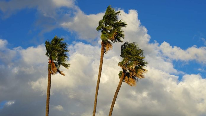
LOS ANGELES (CNS) – Gusty winds and a significant wind event started to blow in Southern California Thursday with strongest winds across the mountains but gusty conditions will extend across the coasts and valleys, particularly of Los Angeles
County and continuing into the weekend forecasted the National Weather Service.
High wind warnings issued by the National Weather Service took effect at 8 p.m. Wednesday and remain in effect until 8 p.m. Thursday in the western Antelope Valley foothills, the Antelope Valley, San Gabriel Mountains and the Golden State (5) Freeway corridor.
“Northwest to northerly winds will then transition to northeast by Friday morning, resulting in a Santa Ana wind event.” said the NWS. “It is important to note that there is a HIGH risk for downed trees and power outages during this wind event due to the soaked soil from recent significant rainfall across the region. Please take extra caution during this time.”
Forecasters said winds of 25 to 40 mph are possible in most of the affected areas, with gusts of up to 65 miles per hour possible.
A separate high wind warning will take effect at 6 a.m. Thursday and continue through 1 p.m. Saturday for the San Gabriel Mountains and Antelope Valley (14) Freeway corridor, where gusts as high as 70 mph are possible, according to the NWS.
“Hazardous travel risks will be present in areas such as the I-5 through the grapevine as strong winds will impact vehicles, especially high profile vehicles. Blowing debris will [also] impact roads, so expect some travel delays, the NWS said. “In addition to
the winds, light snow is possible down to the Tejon Pass as northerly upslope winds will tap into the limited [moisture] remaining, creating some snow flurries.”
A less severe wind advisory will be in effect from 6 a.m. Thursday to 1 p.m. Saturday for the Santa Clarita Valley, Malibu Coast, Calabasas, Agoura Hills, the eastern Santa Monica Mountains Recreational Area and the western San Fernando Valleys. Those areas could see winds of 20 to 30 mph, gusting up to 50 mph.
Los Angeles County beaches, the Palos Verdes Hills, eastern San Fernando Valley, San Gabriel Valley and the inland coastal area including downtown Los Angeles will be under a wind advisory from 6 a.m. to 8 p.m. Thursday, with gusts up to 40 mph possible.
The windy conditions are expected to continue into the weekend, with a “long-duration moderate to strong Santa Ana wind event” beginning Thursday night, according to the NWS. The Santa Ana conditions will lead to warmer temperatures and drier conditions, according to forecasters.
“Santa Ana winds are expected across the typical wind-prone corridor, focused over L.A. and Ventura counties, all the way into mid next week,” according to the NWS. “Wind will be the strongest during this event Thursday night through Saturday morning. Warning Level winds (gusts of 50-70 mph) are expected across the San Gabriel Mountains and Santa Susana Mountains, and possibly the Santa Monica Mountains and the I-5 corridor. Advisory level winds are likely across the Santa Ana Wind corridor in L.A. and Ventura counties early Friday through Saturday morning.”
Forecasters said despite the long duration of the Santa Ana wind event, red flag warnings of elevated wildfire danger are not expected to be issued due to the recent heavy rains.

Recent Comments