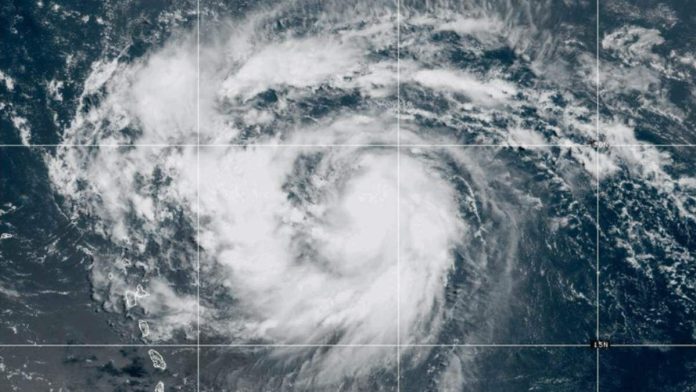
Hurricane Erin has become the first hurricane of the 2025 Atlantic season, reaching Category 1 status with sustained winds of 75 mph as of Friday (August 15). According to the National Hurricane Center (NHC), Erin is currently moving west-northwest at 18 mph and is expected to pass near or north of the Northern Leeward Islands over the weekend.
Tropical storm watches are in effect for Anguilla, Barbuda, St. Martin, St. Barthelemy, Saba, and St. Eustatius, where breezy and rainy conditions are anticipated. Erin is projected to strengthen rapidly, potentially reaching Category 4 status with winds up to 140 mph.
The storm’s outer bands could bring 2 to 4 inches of rain to Puerto Rico and the U.S. Virgin Islands, with isolated areas receiving up to 6 inches. This could lead to flash flooding and mudslides. Looking ahead to next week, Erin is expected to stay east of the Bahamas, with large waves and life-threatening rip currents affecting the U.S. East Coast, particularly North Carolina’s Outer Banks, where waves could reach 8 to 12 feet.
While the majority of models predict Erin will remain hundreds of miles offshore, the situation remains fluid. The NHC emphasizes the uncertainty of Erin’s exact impact on the East Coast, Bahamas, and Bermuda.
The Atlantic hurricane season, which runs from June 1 to November 30, is expected to be above average, with forecasters predicting 13 to 18 named storms.

Recent Comments