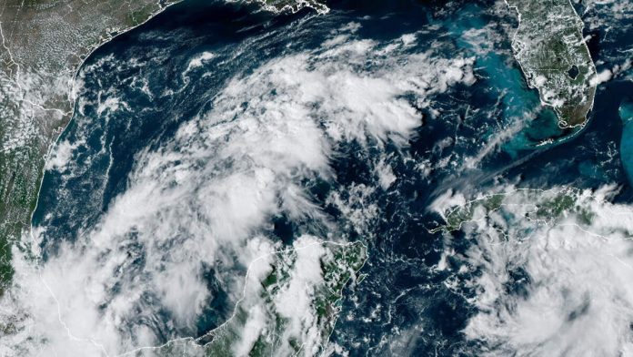
A tropical disturbance is expected to move into the Gulf of Mexico and could potentially develop into a tropical depression over the weekend, according to the National Hurricane Center. The system, which is currently producing disorganized showers and thunderstorms over the northwestern Caribbean Sea and the southwestern Gulf of Mexico, is expected to move north over the Gulf of Mexico later this week and into the weekend.
The disturbance has emerged from a broad low-pressure area over Central America known as the Central American Gyre. This large rotating system is forecast to ease north over the Gulf of Mexico late in the week and into the weekend. Within this large, low-pressure zone, an organized tropical system might develop over the days that follow. FOX Weather Hurricane Specialist Bryan Norcross stated that the models are all over the place when it comes to predicting where the system will organize and move.
The National Hurricane Center has given the system a medium chance of developing into at least a tropical depression. Their potential development area covers the entire Gulf, reflecting the size and scope of the parent area of low pressure. Regardless of development, locally heavy rains could occur over portions of Mexico during the next several days and over portions of the Florida Peninsula by the weekend.
AccuWeather has warned that Florida “may be the prime target” for any budding system next week. This is unwelcome news for Florida, which was hit by Category 4 Hurricane Helene less than a week ago. According to the News-Press, residents along the entire Gulf Coast have been advised to monitor the system closely and be prepared.

Recent Comments