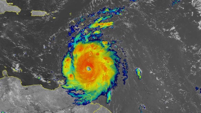
Hurricane Beryl strengthened into a monster Category 4 storm as it bared down on Windward Islands in the southern Caribbean on Monday (July 1). While the storm may not make true landfall, where the eye passes over the coast, as it blows by the islands, it could have a devastating impact on Barbados, Trinidad and Tobago, St. Vincent, the Grenadines, and Grenada, bringing dangerous winds, flooding rains, and life-threatening storm surges.
“A life-threatening storm surge will raise water levels by as much as 6 to 9 feet above normal tide levels in areas of onshore winds near where the eye makes landfall in the hurricane warning area. Near the coast, the surge will be accompanied by large and destructive waves,” the National Hurricane Center said. “Hurricane Beryl is expected to produce rainfall totals of 3 to 6 inches across Barbados and the Windward Islands through this afternoon. Localized maxima of 10 inches are possible, especially in the Grenadines and Grenada. This rainfall may cause flash flooding in vulnerable areas.”
While Beryl is expected to weaken a bit as it moves across the Windward Islands, it is still forecast to remain a hurricane as it continues to travel west at about 20 mph.

Recent Comments