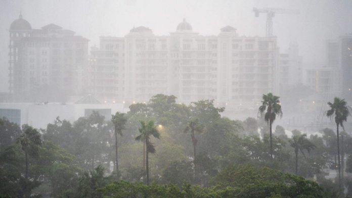
Hurricane Milton made landfall in Siesta Key, Florida, as a Category 3 storm Wednesday (October 9) night, NBC News reports.
Florida Gov. Ron DeSantis warned residents that “now is the time to shelter in place” as the storm approached the west coast of the state.
“First responders are staged and ready to go, as soon as weather conditions allow,” DeSantis wrote on his X account at around 8:20 p.m. local time. “Search and rescue efforts will be well underway to save lives before dawn, and they will continue for as long as it takes.”
The “catastrophic” storm is currently a Category 3, but growing in size with surge warnings covering nearly the entire western coast of Florida.
On Monday (October 7), Tampa Mayor Jane Castor warned that residents ignoring calls to evacuate ahead of Hurricane Milton “are going to die” during an interview with CNN‘s Kaitlan Collins.
“I can say this without any dramatization whatsoever, if you choose to stay in one of those evacuation areas, you are going to die,” Castor said while describing the consequences of the “literally catastrophic” hurricane on a path to hit Florida’s western coast.
At least 85% of beaches along the state’s west coast are forecast to be continuously covered by ocean water when the hurricane, predicted to be one of the strongest storm systems ever, makes landfall on Wednesday (October 9), as many in the area continue recovery efforts from Hurricane Helene.
“This is the most severe level of coastal change,” the U.S. Geological Survey warned via the New York Post, noting that “Milton’s waves and surge” could cause “erosion and overwash” to all of the state’s beaches.
“The significance of the coastal change forecast for Milton’s impact to the Florida west coast cannot be overstated,” said USGS scientist Kara Doran.
Several meteorologists have called for the Saffir-Simpson Hurricane Wind Scale to be expanded to include a new sixth category for hurricanes.
“Milton might have actually breached the 192 mph ‘cat 6′ cutoff,” professor Michael E. Mann wrote on X.
Milton is reportedly expected to hit parts of west-central Florida at a “unique angle of approach” which could be the worst storm system to hit Florida in “over 100 years,” according to FOX Weather.
A track shows the hurricane over or just north of the Tampa-Sarasota metro area, which would bring significantly more water piled up than previous hurricanes in the region.
“The West Coast of Florida is spectacularly vulnerable to storm surge, as we have seen. Even a tropical storm can push Gulf water to dangerous heights, let alone a strong hurricane. It’s critical that everybody in Central and South Florida stay well-informed since things are developing quickly,” said FOX Weather Hurricane Specialist Bryan Norcross.
Pinellas, Manatee and Sarasota are all expected to announce evacuation orders on Monday and Kevin Guthrie, the director of Florida’s emergency management division, said the state was preparing for its largest evacuation since 6 million Floridians were forced to flee ahead of Hurricane Irma in 2017. Rainfall is expected to be between 5-10 inches in some areas of the state, while others can see up to 15 inches. A deadly storm surge of 8-12 feet is also possible for more than 200 miles of coastline, with Tampa potentially being the median.
“The track guidance is in good agreement that the hurricane will cross the Florida Peninsula, but there remains significant differences in both the location and timing of landfall,” National Hurricane Center specialist Jack Beven wrote via USA TODAY.

Recent Comments