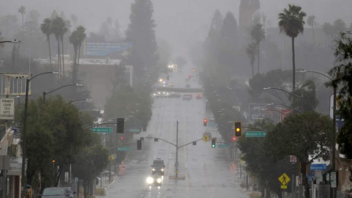
A powerful winter storm system is battering California Tuesday (February 17) with flooding rains and heavy mountain snow after Monday’s deluge shattered rainfall records across the state.
The storm has triggered flash flood warnings for millions of residents as a plume of moisture from the Pacific Ocean pushed inland, dropping 1-2 inches of rain across the Los Angeles Basin and 3-5 inches in coastal ranges north of the Bay Area, according to Fox Weather.
Urban flooding swamped parts of Los Angeles on Monday, with water rising to mid-door level on some vehicles in the Westwood neighborhood. Parts of Topanga Canyon Boulevard were closed due to debris slides, while Los Angeles County received its fifth Severe Thunderstorm Warning in two years after going eight years without one.
“It has seemed ‘springlike’ for a large part of 2026, but winter is set to show it’s not quite done yet,” the Shasta County Sheriff’s Office said in a social media post urging residents to stay aware of the storm.
The storm wreaked havoc on roadways from Sonoma County to the Sierra Nevada. Traffic was temporarily halted in both directions on I-80 near the Nevada state line due to spinouts and crashes. In Santa Barbara County, a large tree toppled onto US-101, shutting down southbound lanes.
Los Angeles Mayor Karen Bass ordered emergency crews and city departments to be ready to respond to problems, while California’s Office of Emergency Services positioned fire and rescue personnel in areas most at risk for flooding and debris flows.
Forecasters expect more rain across the state Tuesday, with the heaviest precipitation hitting San Francisco through Tuesday morning and reaching Los Angeles Tuesday night. A third, less intense round of rain is forecast for Thursday.
In the mountains, heavy snow is spreading from Northern California ranges into the southern Sierra Nevada. Wind gusts between 45-55 mph are creating whiteout driving conditions across northern mountain passes. The western slope of the Sierra Nevada, northern Shasta County, and parts of the state’s Coast Range could see up to 8 feet of snow before the storm moves through late Wednesday.
“The heavy snow, wind and low visibility could make travel conditions dangerous to near impossible,” forecasters warned.
While the storms have caused disruptions, including the closure of Six Flags Magic Mountain and early shutdown of Knott’s Berry Farm on Monday, they bring welcome relief to a region suffering from snow drought. The American West has experienced record-low snow levels, with Utah measuring snow-water equivalent at just 6 percent across the state, a low not seen since 1981.
For residents in areas scarred by last year’s wildfires, evacuation warnings remain in effect through Tuesday due to potential mud and debris flows.
The storm system is expected to move eastward later this week, bringing much-needed snow to the Rockies, where some snowpacks are at record lows.

Recent Comments