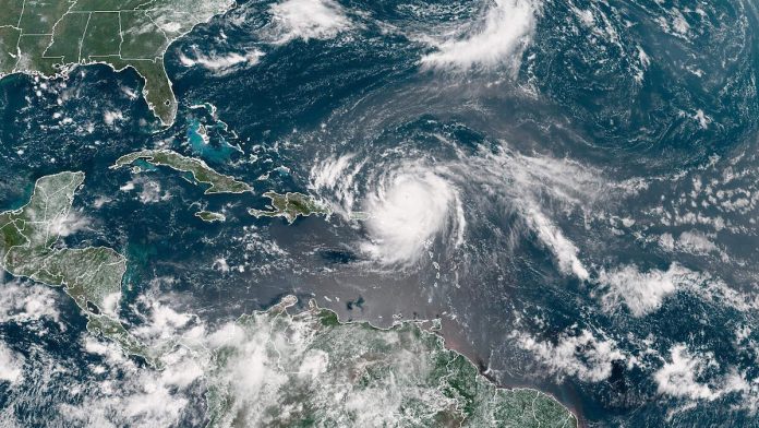
Hurricane Erin flexed back to a Category 4 Sunday (August 17) night, reaching winds of up to 156 MPH after “completing an eyewall replacement cycle,” the National Weather Center announced in a post on its X account.
“Hurricane #Erin Advisory 27: Erin Re-Intensifies Into a Category 4 Hurricane After Completing An Eyewall Replacement Cycle. Life-Threatening Surf and Rip Currents Likely Across the U. S. Eastern Seaboard as Erin Becomes a Very Large Hurricane This Week,” the agency wrote.
The hurricane was reported to be “located just east of the southeast Bahamas” as of Monday (August 18) morning with “life-treatening surf and current rips likely across the U.S. Eastern Seaboard” expected this week.
Erin, which registered as a Category 5, was initially downgraded to a Category 4 and later a Category 3 on Sunday, but remained a hurricane, the first to reach that status and the fifth names storm of the Atlantic hurricane season. Shores along the United States weren’t expected to not be directly hit by Erin, however, a strong offshore hurricane capable of massive and dangerous waves well away from its center is possible, according to AccuWeather Lead Hurricane Expert Alex DaSilva.
“The storm is forecast to remain hundreds of miles off the East Coast,” DaSilva said at the time, adding that “beaches along the entire East Coast, from Florida to New England and Atlantic Canada, will likely experience rough surf and dangerous rip currents as Erin tracks north and eventually northeast.”

Recent Comments